Bacalar Lagoon: Complete Guide, Cenotes and What to See
Last updated October 2026 by Ricardo R
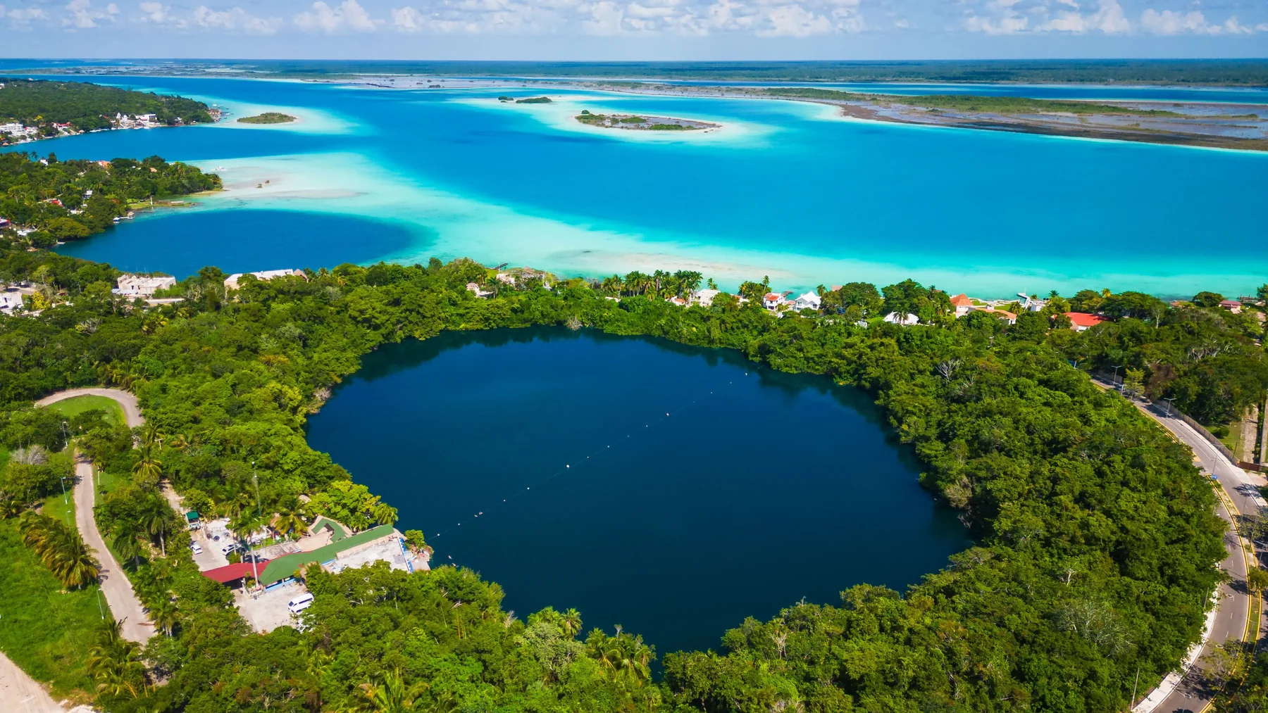
The Bacalar Lagoon, located in the south of Quintana Roo, Mexico, is an extensive freshwater lagoon known for its multiple shades of blue, submerged cenotes, mangroves, natural channels, and microbial formations. Its landscape combines karst geology, groundwater, biodiversity, and some of the most representative natural scenery of the Mexican Caribbean.
This guide brings together the main attractions of Bacalar Lagoon, its geological origin, its cenotes, stromatolites, fauna, mangroves, and the best ways to explore it.
Why does Bacalar Lagoon have seven colors?
Bacalar Lagoon presents different shades of blue and turquoise due to variations in depth, the color of the bottom, the transparency of the water, and the incidence of sunlight. The name 'Lagoon of the Seven Colors' does not refer to seven exact colors, but to the variety of shades visible throughout the lagoon.
In shallow areas, the light-colored bottoms reflect more light and produce intense turquoise tones. In contrast, over cenotes and deep areas, the water takes on dark blue shades.
The transparency of the water also allows these changes to be especially visible from a boat, a dock, or even from the air.
How was Bacalar Lagoon formed?
Bacalar Lagoon was formed over a limestone rock platform affected by fractures, geological faults, and karst dissolution processes. Over time, rainwater and underground flows eroded the rock, creating cavities, cenotes, channels, and depressions that gave rise to the current lagoon system.
The elongated shape of Bacalar is related to regional geological structures associated with the Hondo River fault zone.
Afterwards, for thousands of years, the circulation of groundwater continued to modify the limestone.
Therefore, Bacalar should not be understood as a lagoon formed at a single moment, but rather as the result of a long interaction between geology, water, and erosion.
What is the water of the Bacalar Lagoon composed of?
The water of the Bacalar Lagoon is primarily fresh and contains minerals from the limestone of the Yucatán Peninsula, especially calcium and bicarbonates. Its chemistry, combined with naturally low levels of nutrients and the activity of microorganisms, favors the formation of microbialites and helps explain the extraordinary transparency of the water.
A large part of the water reaches Bacalar through underground flows.
Before reaching the lagoon, it passes through limestone and acquires the minerals that characterize its composition.
This chemical balance also makes Bacalar an ecosystem particularly sensitive to changes caused by pollution, sediments, or excess nutrients.
Pirates' Channel: what it is and why it is famous
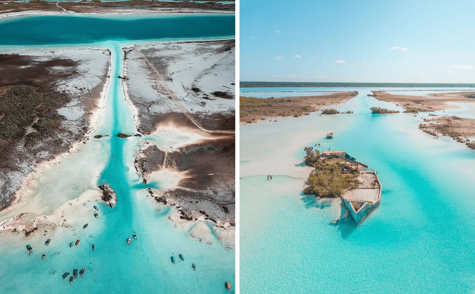
The Pirates' Channel is a narrow waterway that connects the Bacalar Lagoon with other lagoon bodies to the east and is one of its most visited attractions. It is famous for its shallow turquoise waters and for having been part of ancient trade routes that were exposed to pirate incursions during the colonial era.
Today it is one of the most photographed spots in Bacalar.
Its clear bottoms produce some of the most intense turquoise tones in the entire lagoon and its shallow waters make it a common area for swimming.
The canal also serves as a gateway to lesser-known landscapes of mangroves, wetlands, and ancient waterways.
Local recommendation: if you can choose a time, visit this area in the morning. The light usually makes the turquoise tones appear more intense and it is generally enjoyed with a calmer feeling than during the peak hours of the day.
Learn more about the Pirate Canal and its history
Bird Island: what it is and what can be seen
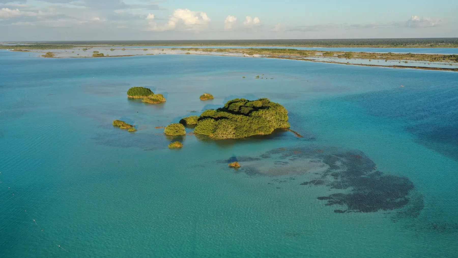
Bird Island is a small natural island within the Bacalar Lagoon that serves as a refuge, resting area, and feeding ground for various species of birds. From a boat, herons, cormorants, and other aquatic birds can be observed, especially during the calmer hours of the day.
It is not a place meant for landing.
Its value lies precisely in observing it from a distance and allowing the birds to remain undisturbed in their natural environment.
That is why it is part of many navigation routes through Bacalar, but it should always be visited respectfully.
Local recommendation: do not try to get too close to the island. The best experience is to observe it from a distance, with the boat moving slowly or stopped, and spend a few minutes looking in silence. It is when it is easiest to discover birds among the vegetation.
Learn more about Bird Island in Bacalar
Cocalitos: what it is and why it is important
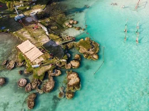
Cenote Cocalitos is a cenote integrated into the Laguna de Bacalar known for its transparent waters and the presence of large microbial formations. The area is especially important because it allows for the observation of microbialites, mineral structures created by communities of microorganisms that are part of the delicate ecosystem of Bacalar.
Cocalitos combines geology and biology in the same landscape.
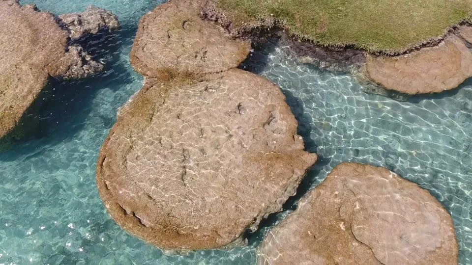
The rounded structures visible near the surface are often called stromatolites, although scientifically many are classified more broadly as microbialites.
These formations are extremely fragile and should not be touched, stepped on, or used as platforms.
Learn more about Cenote Cocalitos and its microbialites
 Cenote Esmeralda: where it is and what makes it special
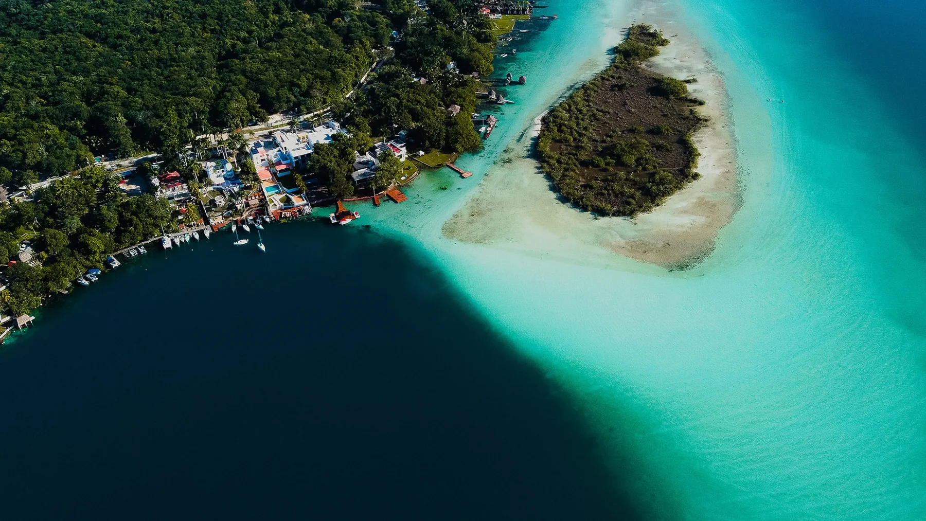
Cenote Esmeralda is a large submerged cenote within the Laguna de Bacalar, located in front of the urban area. It is distinguished by the visible change in water color: the turquoise shades of the shallow areas transform into deep blue when the bottom descends over the cenote.
This contrast makes it easy to understand why Bacalar presents so many different colors.
From a boat, the boundary between the clear bottom of the lagoon and the depth of the cenote can be observed quite clearly.
It is one of the points frequently included in classic navigation routes.
Local recommendation: When you pass over the Cenote Esmeralda, take a few seconds to look directly at the water instead of just looking for a photograph. From the boat, you can see very well how the color and depth change in just a few meters.
Learn more about the Cenote Esmeralda in Bacalar
 Cenote Negro: what is its depth and why is it called that
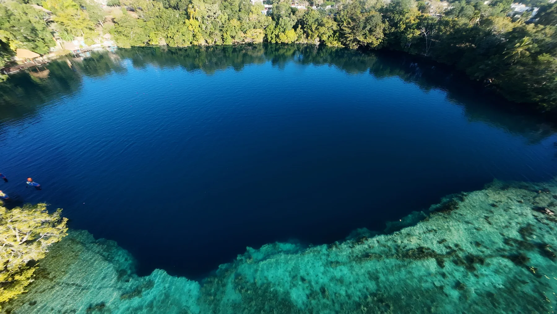
Cenote Negro, also known as Cenote de la Bruja, is one of the deepest cenotes in the Bacalar Lagoon and exceeds 60 meters in depth. Its name comes from the intense dark blue tone that the water takes over the cavity, creating a strong contrast with the turquoise areas that surround it.
The change in depth occurs quite abruptly.
Therefore, from the surface, it seems that the water changes color almost instantly.
In addition to being one of the most striking scenes in the lagoon, Cenote Negro helps to understand the relationship between the cenotes and the geological system of Bacalar.
Learn more about the Cenote Negro in Bacalar
 Cenote Azul in Bacalar: what it is and why it is different
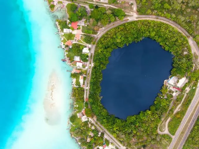
Cenote Azul in Bacalar is a large freshwater cenote located south of the city of Bacalar, next to the lagoon but separated from its main body. It is part of the same karst landscape of the region and stands out for its intense blue color, its almost circular shape, and its considerable depth.
Unlike Cenote Negro, Cenote Esmeralda, and Cocalitos, which are visually part of the tour within the Bacalar Lagoon, Cenote Azul is perceived as an independent body of water.
Its color changes rapidly from light tones near the shore to deep blue in the deeper areas, surrounded by tropical vegetation.
It is one of the most well-known cenotes in Bacalar and a good option for those who want to complement a navigation through the lagoon with a different experience from land.
Important fact: although it is usually mentioned along with the attractions of the Laguna de Bacalar, the Cenote Azul is separated from the lagoon at the surface. Both are part of the karst landscape and the regional hydrological system.
Learn more about the Cenote Azul in Bacalar
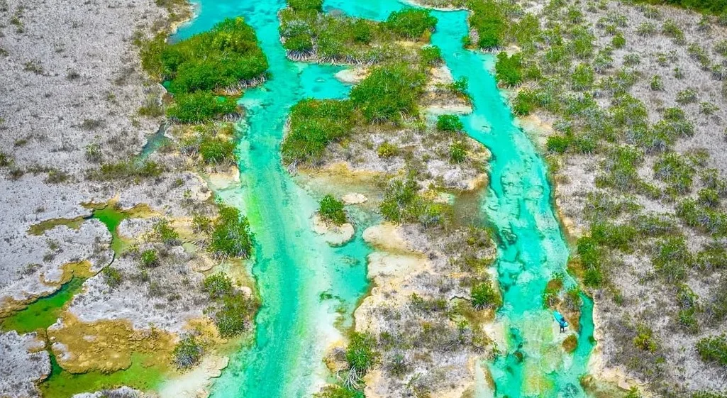 Estero de Chac: what it is and where it is located
The Estero de Chac is an area of channels, wetlands, and vegetation connected to the lagoon system of Bacalar. Its landscape is narrower and more natural than that of the main lagoon, with mangroves and aquatic corridors that show how Bacalar is part of a much larger hydrological network.
Here the landscape changes completely.
The large open spaces give way to channels surrounded by vegetation and shallow areas.
It is one of the best areas to understand that the Laguna de Bacalar does not function in isolation, but as part of a regional system of lagoons, wetlands, and groundwater.
Discover the Estero de Chac and the Pirate Route
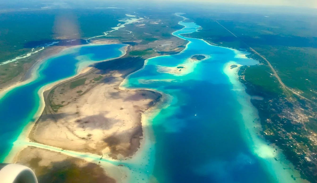 Lagoon system of Bacalar: Xul-Há, Milagros, Bacalar, Chile Verde, and Guerrero
The lagoon system of Bacalar is made up of several lagoons, wetlands, cenotes, and underground flows connected to each other. Among its main bodies of water are Xul-Há, Laguna Milagros, Laguna de Bacalar, Chile Verde, and Laguna Guerrero, which are part of an extensive hydrological network in southern Quintana Roo.
The connections between these lagoons are not always visible.
Some occur through surface channels, while others depend on underground flows that traverse the limestone rock.
Together they form an aquatic system that is also related to the Hondo River and Chetumal Bay.
Xul-Há: what it is and how it relates to Bacalar
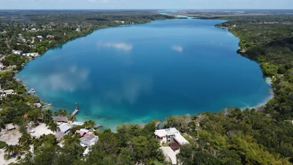
Xul-Há is a lagoon located south of Bacalar and is part of the same regional hydrological system. Its waters, wetlands, and underground connections contribute to the natural flow of water towards the Bacalar system, making it an important piece for understanding the functioning of the lagoon region.
The environment of Xul-Há combines areas of jungle, wetlands, and bodies of clear water.
It is a much quieter region than Bacalar and maintains a direct relationship with the hydrological processes of southern Quintana Roo.
Learn more about Xul-Há
Laguna Mariscal: what it is and how it connects with Bacalar
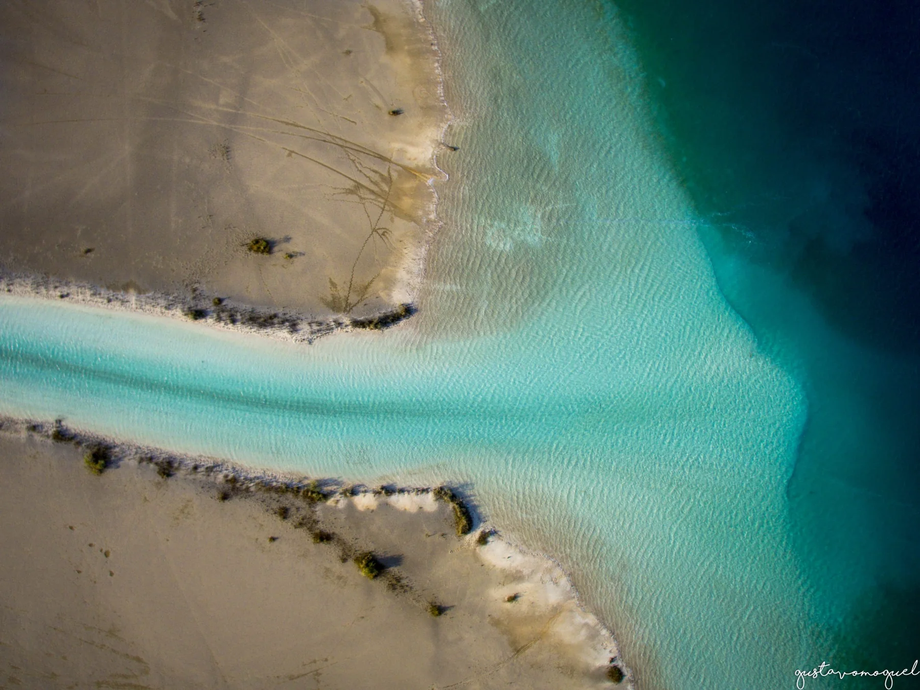
Laguna Mariscal is a body of water located east of the Laguna de Bacalar and connected to it through the Canal de los Piratas. It is part of the regional lagoon system of southern Quintana Roo and helps to understand how Bacalar integrates into a broader network of lagoons, channels, wetlands, and water flows.
Although it receives much less attention than Bacalar, Laguna Mariscal is important from a geographical and hydrological perspective.
The Canal de los Piratas serves as one of the natural connections between both bodies of water and, historically, these passages helped to connect the interior of the region with other water routes.
Its environment is more remote, with a much lower presence of tourist infrastructure and greater prominence of wetlands, vegetation, and natural landscapes.
To understand Bacalar in depth, Laguna Mariscal is a key piece: it shows that the so-called Lagoon of Seven Colors does not exist in isolation, but within a much larger aquatic system.
Learn more about Laguna Mariscal and its connection to Bacalar
Laguna Milagros: where it is and what characterizes it
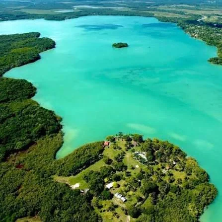
Laguna Milagros is a freshwater body located near Huay-Pix, south of Bacalar. It is part of the regional lagoon system and is characterized by its calm waters, tropical vegetation, and hydrological connection with other bodies of water in southern Quintana Roo.
Unlike Bacalar, it is a more compact lagoon and less developed for tourism.
Its environment retains a calm and local feel, surrounded by vegetation and small access points to the water.
Learn more about Laguna Milagros and Huay-Pix
Laguna Chile Verde: what role it plays in the Bacalar system
Laguna Chile Verde is a body of water located north of Bacalar that is part of the regional hydrological network. Its function is important because it participates in the connections between lagoons, wetlands, and other bodies of water that lead to the area of Chetumal Bay.
It is one of the lesser-known pieces of the system.
However, understanding its location helps to visualize Bacalar as part of a much larger aquatic landscape and not simply as an independent lagoon.
Guerrero Lagoon: what it is and where it is located
Guerrero Lagoon is a lagoon body located northeast of Chetumal that is part of the complex system of lagoons and wetlands in southern Quintana Roo. It is within the hydrological network that connects different freshwater and brackish water environments near Chetumal Bay.
Its surroundings are dominated by tropical vegetation, mangroves, and wetlands.
Together with other lagoons in the region, it helps to understand how water moves from the interior of the peninsula to the coast.
Stromatolites of Bacalar: what they are and why they are important
The stromatolites of Bacalar are mineral formations created by communities of microorganisms that trap sediments and promote the precipitation of calcium carbonate. Many of the current structures in Bacalar are more broadly classified as microbialites, and represent modern versions of biological processes that have existed on Earth for billions of years.
It does not mean that the current stromatolites of Bacalar are billions of years old.
What is extraordinary is the process by which they are formed.
Communities of bacteria and other microorganisms interact with the minerals present in the water and slowly build these structures.
That is why they are considered authentic natural laboratories to study processes related to the earliest forms of life on the planet.
Learn more about the stromatolites of Bacalar
Microbialites of Bacalar: what is the difference with stromatolites
Microbialites are mineral structures created by microorganisms, while stromatolites are a specific type of microbialite characterized by visible layers. In Bacalar, many of the formations popularly known as stromatolites actually present thrombolitic structures and belong to the broader group of microbialites.
For a visitor, the difference may seem small.
For scientists, it is important.
“Microbialite” serves as a general term, while “stromatolite” describes a particular architecture within that group.
That is why both words frequently appear when talking about Bacalar.
Mangroves of Bacalar: what function do they serve
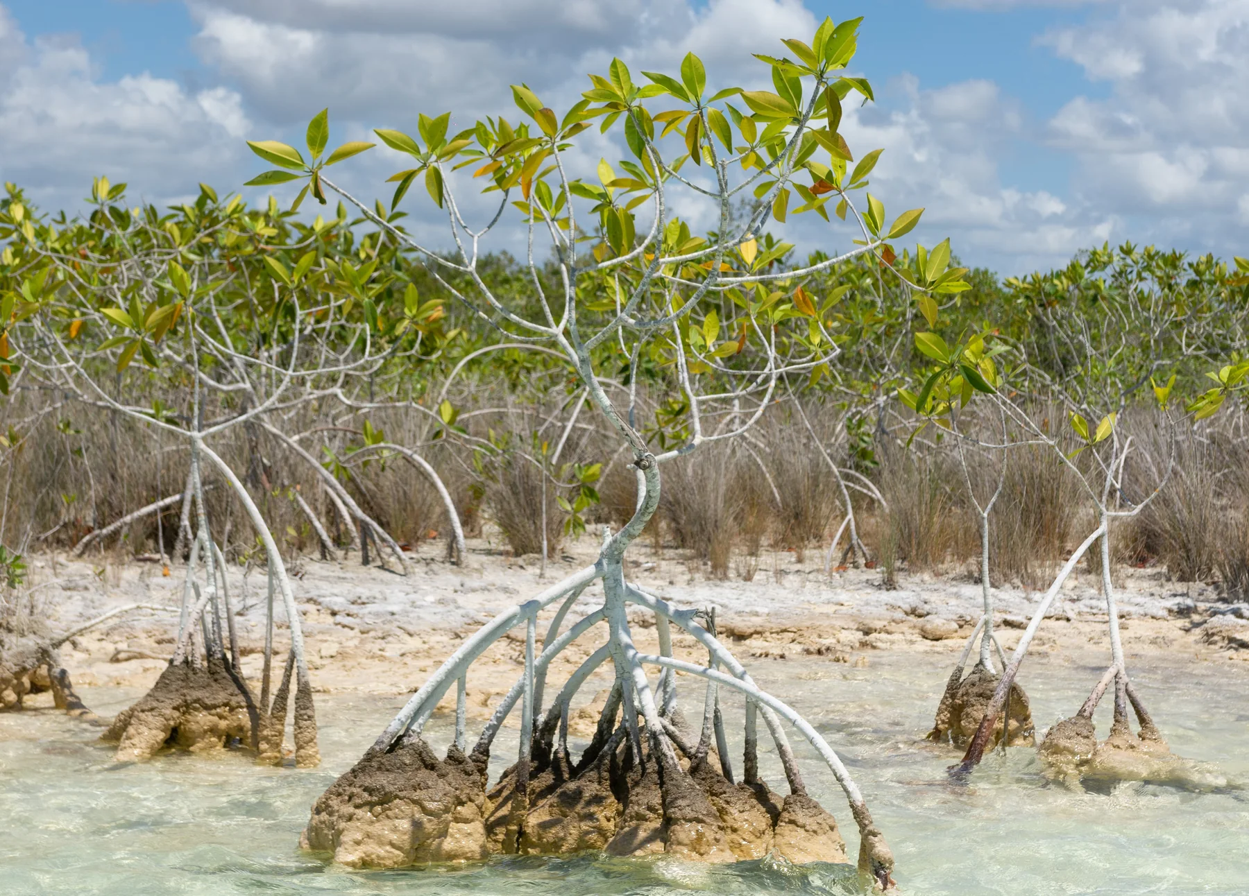
The mangroves of Bacalar protect the shores, retain sediments, filter water, and create shelters for fish, birds, mollusks, and other animals. They also help connect terrestrial ecosystems with aquatic ones and are essential for maintaining the ecological stability of the lagoon and its wetlands.
Their roots function as a kind of natural protective structure.
They reduce erosion, trap materials before they enter the lagoon, and create protected areas where many species can feed or reproduce.
From a kayak or a small boat, the complexity of this ecosystem can be especially well appreciated.
Learn more about the mangroves of Bacalar
Fauna of the Bacalar Lagoon: what animals live here
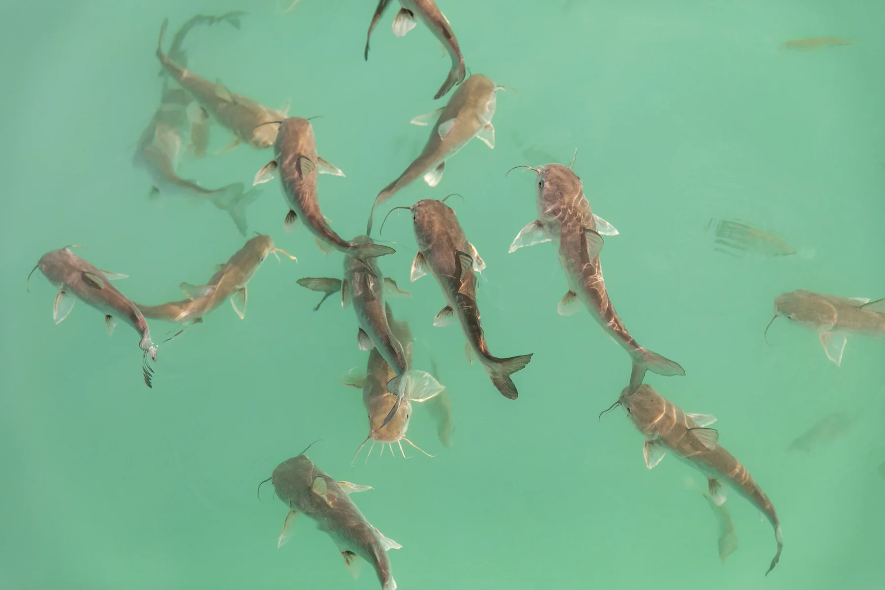
The fauna of the Bacalar Lagoon includes fish, water birds, reptiles, amphibians, small mammals, and numerous invertebrates. Among the most visible species to visitors are herons, cormorants, kingfishers, and other birds associated with mangroves, wetlands, and small islands.
Much of the biodiversity remains out of sight.
Many animals hide among roots, vegetation, and deep areas of the lagoon.
Scientific studies have also identified a significant diversity of fish and other vertebrates using techniques such as environmental DNA analysis.
Learn more about the fauna of the Bacalar Lagoon
Flora of the Bacalar Lagoon: what vegetation exists
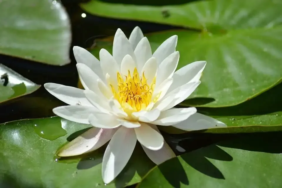
The vegetation of Bacalar consists of mangroves, tropical rainforest, wetland plants, and aquatic species adapted to the conditions of the lagoon system. Among the mangroves in the region are species such as red mangrove, white mangrove, and buttonwood.
This vegetation is not only part of the landscape.
It also helps stabilize the shores, provide shade and food, conserve habitats, and filter some of the sediments that reach the water.
Rainforest, wetland, and lagoon function as a single ecological system.
Learn more about the flora of the Bacalar Lagoon
What is the best way to get to know the Bacalar Lagoon?
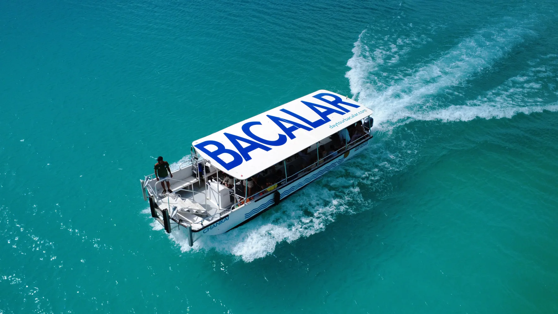
The best way to get to know the Bacalar Lagoon is to combine navigation with time to swim and observe its main attractions. Tours on pontoon boats, sailboats, and catamarans allow for greater distances, while kayaking and paddleboarding are ideal for exploring shallow areas and enjoying the lagoon at a more relaxed pace.
For a first visit, a tour of approximately three hours allows you to see several of the most representative points.
Those looking for a more active experience can choose paddleboarding or kayaking.
For couples, families, and groups who desire more privacy there are also private tours.Private.

Tours of the Bacalar Lagoon with DayTour Bacalar
DayTour Bacalar offers shared and private tours to explore the Bacalar Lagoon by pontoon, sailboat, catamaran, kayak, and paddleboard. The routes allow visiting some of the main attractions of the lagoon, such as the Pirate Canal, Bird Island, Emerald Cenote, Black Cenote, and areas of microbialites.
Each type of vessel offers a different way to experience Bacalar.
Pontoons are comfortable and spacious; sailboats and catamarans provide a calmer navigation; and paddleboarding and kayaking allow access to shallow areas.
There are also special experiences for travelers who wish to explore lesser-known routes outside the usual circuit.
Explore all the tours and experiences of DayTour Bacalar
How to care for the Bacalar Lagoon
To protect the Bacalar Lagoon, it is important not to touch or walk on the microbialites, avoid waste and pollutants, respect the mangroves, maintain distance from wildlife, and follow environmental and navigation restrictions. The conservation of water quality is essential to protect this ecosystem.
Bacalar is a naturally low-nutrient system.
This helps maintain its transparency, but it also means that changes caused by pollution or excess nutrients can disrupt its balance.
The best visit is the one that leaves the least footprint possible.
Learn how to help protect the Bacalar Lagoon during your visit
Frequently asked questions about the Bacalar Lagoon
Where is the Bacalar Lagoon?
The Bacalar Lagoon is located in the municipality of Bacalar, in the south of the state of Quintana Roo, Mexico, approximately 35 kilometers north of Chetumal and near the border with Belize.
Its location makes it one of the main natural destinations in the southern Mexican Caribbean.
Is the Bacalar Lagoon freshwater or saltwater?
The Bacalar Lagoon is predominantly freshwater. Its water comes mainly from rain and underground flows that pass through the limestone of the Yucatán Peninsula before reaching the lagoon system.
This underground circulation also explains much of its mineral composition.
What are the main attractions of Bacalar Lagoon?
The main attractions of Bacalar Lagoon are the Pirate Canal, Bird Island, Black Cenote, Emerald Cenote, Cocalitos, stromatolites and microbialites, as well as its mangroves, wetlands, and different shades of blue.
These places can be explored by boat, kayak, paddleboard, or land access.
How much time is needed to explore Bacalar Lagoon?
A three-hour tour allows you to see several of the main attractions of Bacalar Lagoon, but to enjoy the destination peacefully, it is recommended to stay between two and three days. This way, it is possible to combine navigation, sunrise, gastronomy, kayak, paddleboard, and other places in the region.
Bacalar especially rewards those who do not try to see everything in a hurry.
Bacalar is better understood from the water.
Bacalar Lagoon is much more than a turquoise water landscape: it is a natural system formed by limestone, cenotes, underground waters, mangroves, microbialites, wetlands, and a great diversity of species. Navigating through it allows you to understand how all these elements are connected.
Its famous seven colors are only the first impression.
When you learn about its geology, observe its cenotes, and understand the importance of its microbialites and mangroves, Bacalar begins to reveal a much more interesting story.
And that story is precisely what makes Bacalar Lagoon one of the most unique ecosystems in Quintana Roo.
Keep discovering Bacalar.
Bacalar Lagoon is just the beginning. Beyond its cenotes, channels, mangroves, and waters of different shades, the destination holds towns, restaurants, sunrises, natural routes, spas, and experiences worth discovering at a leisurely pace.
In our Bacalar Guide you will find local recommendations, practical articles, places to visit, and tips to make the most of your stay in one of the most special destinations in southern Quintana Roo.
Continue discovering Bacalar in our Bacalar Guide
Traveling to Bacalar?
Complete your experience by exploring the Lagoon of Seven Colors with DayTour Bacalar.
View Tour Catalog